فيديوهات شرح منظومة سمارت جى اى اس Smart GIS Tutorials Videos
Introduction
A Geographic Information System (GIS) is a computer program for storing, retrieving, analyzing, and displaying cartographic data.
GIS Software Programming is impacted by various sciences, which are integral to the GIS programming such as geographic, graphic, database, operating research, software engineering, software programming and code enhancement.
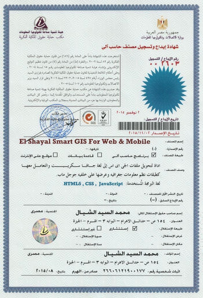
تسجيل منظومة سمارت جى اى اس ايتيدا Smart GIS Registeration in ITIDA
https://login.itida.gov.eg/ViewProfileFull.aspx?ID=2814
شهادات منظومة سمارت جى اى اس Smart GIS Certificates
https://drive.google.com/folderview?id=0B2qR4wxKKE_VflFBZk5mcTRneWRoTVhMLUlPTXZ6SXJuOUdfdFp6amMyQURHSlYxZUoyR0U&usp=sharing
By applying those above mentioned sciences and techniques, to the GIS programming activities, we achieved our GIS Software :
- The software is a GIS standalone applications that Read and write Shape files and attribute tables and present them in layers and give the user the full GIS tools such as (zoom in, zoom out, pan, full extend, select, measure distance, edit existing layer, make new layer ) and view these layers as 2D & 3D.
- It also allow the user to query and search map by using attribute data base tables query builder form or by using Spatial Location query builder and data Transfer form.
- Selection Module allows the user to select, edit, copy, and move features from the map view or from the attribute table.
- The software allows the user to build a Shortest Network and measure the Shortest Path between 2 points in any poly line layer.
- GPS tracking Module, which reads from the GPS Device and convert the Lat. & Long. to 23 projection coordinates system such as (Airy , Australian National , Bessel 1841 , Bessel 1841(Namibia) , Clarke 1866 , Clarke 1880 , Everest , Fischer 1960 ,Fischer 1968 , Fischer 1968 , Fischer 1968 , Fischer 1968 , Hough, International , Krassovsky , Modified Airy , Modified Everest ,Modified Fischer 1960 , South American 1969 , WGS 60 , WGS66 , WGS-72 , WGS-84 )
- The software also provide the users by the important tools to Downloads , mosaic Google Earth tiles Map, Covert AutoCAD DXF to Shape file, Convert NASA ASTER and SRTM DEM to tin shape file, Run VB script .
- Feature and vertexes editing module allows the users to snap, rotate, scale, divide, and combine features with unlimited capability to undo and redo all editing.
- Data Table Editing Module allows the users to deal with table cells by copy, cut, past, clear, fill past, fill series with unlimited capability to undo and redo all editing. And it allows also dealing with rows by Sort rows, select, unselect, delete, and undelete functions.
- Layer Properties Module allows the users to control the layer appearance such as view color, selection color, editing color, label, networking settings, modify dbf field date structure, and thematic field colors.
- The software also allow the user to open and rectify (geo-reference) most of the raster images such as bitmap, jpeg, gif, tiff, png files.
Objectives
Developing a GIS, GPS, Database, software with the following features
- Developed by using VB6.
- Independent of any commercial software package, or code library.
- With no support of any governmental Organization.
- Divided into separate modules (up to 30 main modules), And all of these modules can be easily upgraded to be used in building Internet CGI application or Smart Devices VB.net application.
- Free for none commercial use.
Methodology
GIS Elshayal Smart GIS Map Editor development process model is “water fall model” or software life cycle. The fundamental development activities of GIS Elshayal Smart GIS Map editor software are divided among the following stages:-
1. Requirements analysis and definition stage
- Reading, writing, modifying shape files, and data base files.
- Search and query attribute data base tables and spatial data and Transfer data according to its spatial location.
- Select features from attribute data tables, and drawings
- Finding the shortest path between 2 points in any poly line network
- Tracking and saving the GPS route.
- Converting between Lon.& Lat. and 23 projection coordinates system such as (Airy , Australian National , Bessel 1841 , Bessel 1841(Namibia) , Clarke 1866 , Clarke 1880 , Everest , Fischer 1960 ,Fischer 1968 , Fischer 1968 , Fischer 1968 , Fischer 1968 , Hough, International , Krassovsky , Modified Airy , Modified Everest ,Modified Fischer 1960 , South American 1969 , WGS 60 , WGS66 , WGS-72 , WGS-84 )
- Download satellite Images from Google, and download ASTER and SRTM Digital Elevation Module (DEM).
- Strong Edit features and vertexes tools, with snap, rotate, scale, divide, and combine, undo, and redo functions i. Strong Edit Tables tools, with copy, cut, past, clear, fill past, fill series, undo, redo, sort rows, select, and delete functions
- Control the layer appearance such as view color, selection color, editing color, label, networking settings, modify dbf field date structure, and thematic field colors.
- Open and rectify (geo-reference) most of the raster images such as bitmap, jpeg, gif, tiff, png files
2. Software design stage
- 8 main menus, 30 toolbar buttons, and 20 main forms have been designed to reflect the above-mentioned requirements and to give the user the full control of the Software and its functions. Each menu, and form are designed to work with one requirement or function according to the integration and coherence of the functions.
3. Software implementation and testing stage
- 30 main modules contain all formulas and calculations. Each module are written individually and tested by itself. Each module is designed to work with one requirement or function, according to the integration and coherence of the functions.
4. Software integration stage
- Combining the above-mentioned modules, menus, toolbar buttons,and forms in one complete system, which achieves the above mentioned system requirements.
5. Operation and maintenances stage
- The system has been used in several international projects as assistance GIS software in parallel with other international well known GIS software.
- The System is offered as free None commercial use for more than 100,000 users to install it and put it into practical use. Many errors have been discovered and corrected .
Discussion
A) Q. What is a Geographic Information System?
- A. Geographic Information System (GIS) is a computer program for storing, retrieving, analyzing, and displaying cartographic data.
- Vector Spatial Location Data = X, Y, Z
- Attribute Data Base = Data Information
B) The Difference between Raster and Vector Maps
- Maps in Geographic Information Systems are represented thematically. A standard topographic map will show roads, rivers, contour elevations, vegetation, human settlement patterns and other features on a single map sheet. In a GIS these features are categorized separately and stored in different map themes or overlays. For example, roads will be stored in a separate overlay. Likewise, rivers and streams will each be stored as a separate theme. This way of organizing data in the GIS makes maps much more flexible to use since these themes can be combined in any manner that is useful. The following illustration shows conceptually how maps are stored as themes in a GIS.
- Each different theme is stored on a separate overlay. The overlays on the left represent a vector based GIS, where the information is stored as a series of points, lines and polygons. The overlays on the right represent a raster based GIS, where the information is stored as a series of discrete units called cells.
C) The Relation between Vector Spatial Location and Attribute Data Base
- Each Spatial Layer is consist of many Spatial features
- Each Spatial Feature consist of many vertexes (x, y, z)
- Each Spatial Layer is related to one Attribute Data Base Table
- Each Spatial Feature is related to one Attribute Data Base Record
- Each Record consist of many fields (up to 255)
Coordinates System
A) Lon and Lat Geographic Coordinate System
- The geographic latitude (abbreviation: Lat., or phi) of a point on the Earth's surface is the angle between the equatorial plane and a line that passes through that point
- The North Pole is 90° N; the south pole is 90° S. The 0° parallel of latitude is designated the equator, the fundamental plane of all geographic coordinate systems. The equator divides the globe into Northern and Southern Hemispheres.
- The Longitude (abbreviation: Long., or lambda) of a point on the Earth's surface is the angle east or west from a reference meridian to another meridian that passes through that point.
- All meridians are halves of great ellipses (often improperly called great circles), which converge at the north and south poles.
B) Universal Transverse Mercator Coordinate System UTM
- The UTM system divides the surface of Earth between 80°S and 84°N latitude into 60 zones, each 6° of longitude in width and centered over a meridian of longitude. Zone 1 is bounded by longitude 180° to 174° W and is centered on the 177th West meridian. Zone numbering increases in an easterly direction.
- Each of the 60 longitude zones in the UTM system is based on a transverse Mercator projection, which is capable of mapping a region of large north-south extent with a low amount of distortion. By using narrow zones of 6° (up to 800 km) in width, and reducing the scale factor along the central meridian by only 0.0004 to 0.9996 (a reduction of 1:2500), the amount of distortion is held below 1 part in 1,000 inside each zone. Distortion of scale increases to 1.0010 at the outer zone boundaries along the equator.
C) Predefined Spheroid
- AA Airy 1930
- AN Australian National
- BR Bessel 1841 Ethiopia Indonesia Japan Korea
- BN Bessel 1841 Nambia
- CC Clarke 1866 (NAD 1927)
- CD Clarke 1880
- EB Everest Brunei & E. Malasia (Sabah & Sarawak)
- EA Everest India 1830
- EC Everest India 1956
- EF Everest Pakistan
- EE Everest W. Malasia and Singapore 1948
- ED Everest W. Malasia 1969
- RF Geodetic Reference System 1980 (NAD 1983)
- HE Helmert 1906
- HO Hough 1960
- ID Indonesian 1974
- IN International 1924
- KA Krassovsky 1940
- AM Modified Airy
- FA Modified Fischer 1960 (South Asia)
- SA South American 1969
- WD World Geodetic System 1972 (WGS 72)
- WE World Geodetic System 1984 (WGS 84)
C) Requeried information for Configuring new UTM Projection
- Semi Major Axis
- Semi Minor Axis
- Flattening value
- Central Meridian
- False Easting
- False Northing
- Latitude of Origin
- To WGS84 Transformation 7 shift values factors