فيديوهات شرح منظومة سمارت جى اى اس Smart GIS Tutorials Videos
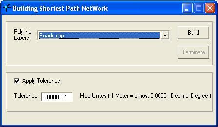
Building Shortest Path Network
Menu → Network → Build Shortest Path Network

Shortest Path Network
Menu → Network → Shortest Path Network
- Select Layer Name
- Select Field Name
- Press From Button
- Select on the map where to start
- Press To Button
- Select on the Map where to Go
- Press Run
تسجيل منظومة سمارت جى اى اس ايتيدا Smart GIS Registeration in ITIDA
شهادات منظومة سمارت جى اى اس Smart GIS Certificates

I recommend you to check this out before installing such apps! This info will help you to be careful online
ReplyDelete