فيديوهات شرح منظومة سمارت جى اى اس Smart GIS Tutorials Videos

First Arabian Egyptian GIS software:
A GIS, GPS, Database, Internet GIS software©
Mohamed El-Sayed El-Shayal
8 Taha Houssin St.
Zamalek – Cairo
Egypt
- Keywords
GIS, GPS, Database, Internet CGI, pocket Pc, Software engineering, and Developing.
- Abstract
Elshayal Smart© software is an almost First Arabian Egyptian GIS software© which completely developed by Arabian Egyptian developers team and independent of any commercial software package. The software current Features are View and Edit shape files, build new layers, add existing layers, remove layers, swap layers, save layers, set layer data sources, layer properties, zoom in & zoom out, pan, identify, selecting features, invert selection, show data table, data query builder, location query builder, build network, find shortest path, print map, save map image, copy map image to clipboard, save project map, edit move vertex, edit move features, snap vertexes, set vertex XY, move settings, converting coordinate system, applying VB script, copy selected features to another layer, move selected features to another layer, delete selected features, edit data table, modify table structure, edit map features, drawing new features, GPS tracking, 3D view, etc... The software expected Features are: Viewing raster image and image geo-referencing, read other map formats such as DXF Format and Tiger Line Format.
- Introduction
A Geographic Information System (GIS) is a computer program for storing, retrieving, analyzing, and displaying cartographic data.
GIS Software is impacted by various sciences, which are integral to the GIS programming such as geographic, graphic, database, operating research, software engineering, software programming and code enhancement.
By applying those above mentioned sciences and techniques, to the GIS programming activities, we achieved our stable version 1.17 of our GIS Software ElshayalSmart.exe.
3.1. The software is a GIS standalone applications that Read and write Shape files and attribute tables and present them in layers and give the user the full GIS tools such as (zoom in, zoom out, pan, full extend, select, measure distance, edit existing layer, make new layer ) and view these layers as 2D & 3D
- The software allows the user to build a Network and measure the Shortest Path between 2 points in any LINE layer.
- It also has location and data Query builder modules, which allow the user to search through the locations or attribute tables of any layer.
- GPS tracking Module, which reads from the GPS Device and can, convert the Lat. & Long. to 23 projection coordinates system such as (Airy , Australian National , Bessel 1841 , Bessel 1841 (Namibia) , Clarke 1866 , Clarke 1880 , Everest , Fischer 1960 , Fischer 1968 , Fischer 1968 , Fischer 1968 , Fischer 1968 , Hough , International , Krassovsky , Modified Airy , Modified Everest , Modified Fischer 1960 , South American 1969 , WGS 60 , WGS 66 , WGS-72 , WGS-84 )
- Selection Module allows the user to select, edit, copy, and move features from the map view or from the attribute table.
- Objectives
Developing the first Arabian GIS, GPS, database, and internet GIS software by Arabian developers’ team and independent of any commercial software package
Developing several versions for different Platforms:
- GIS Editor© for browsing, analyzing and editing maps on the desktop computers (windows 98, 2000, XP, 2003)
- GIS Net© for browsing maps on the Internet Server (windows server 2000,
2003)
- GIS Mobile© for browsing maps on the PDA & Pocket PC (windows CE
.Net)
- Methodology
ElShayal Smart GIS software development process model is “waterfall model” or software life cycle. The fundamental development activities of the software are divided among several stages:
- Requirements analysis and definition
- Converting Lat. and long. to 23 projection coordinates system such as (Airy , Australian National , Bessel 1841 , Bessel 1841 (Namibia) , Clarke 1866 , Clarke 1880 , Everest , Fischer 1960 , Fischer 1968 , Fischer 1968 , Fischer 1968 , Fischer 1968 , Hough , International , Krassovsky , Modified Airy , Modified Everest , Modified Fischer 1960 , South American 1969 , WGS 60 , WGS 66 , WGS-72 , WGS-84 )
- Reading and writing shape files, and data base files.
- Drawing shapes in different scales in 2D view and 3D view and apply GIS functions such as zoom in, zoom out, pan, full extend, select , identify, distance measure, edit, copy, move
- Viewing tables, distinguish the selected features by different color, and edit in tables cells.
- Crawling through the network matrix to calculate the shortest path route between 2 points in any LINE layer.
- Reading GPS coordinates and tracking it in the map
- Saving and retrieving layers properties.
- Achieving fast, small, nice looking software by visual Basic, which can work in desktop, pocket Pc, and internet Server.
- Software design
10 menus, 28 buttons, and 12 forms have been designed to reflect the above-mentioned requirements and to give the user the full control of the Software and its functions. Each menu, button, and form are designed to work with one requirement or function according to the integration and coherence of the functions.
- Software implementation and testing
30 modules contain all formulas and calculations. Each module are written individually and tested by itself. Each module is designed to work with one requirement or function. According to the integration and coherence of the functions.
- Software integration
Combining the above-mentioned Modules, menus, buttons, and forms in one complete system, which achieves the system requirements.
- Operation and maintenances
The System is offered for more than 5000 users to install it and put it into practical use. Many errors have been discovered and corrected.
- Discussion
From scratch GIS software developing, consumes a lot of efforts, and dedicated time and money, while importing ready-made software save a lot of efforts, time, and money. From scratch GIS software developing, gives us knowledge, experiences, and qualifications, while importing ready-made software put us in the audience seats.
- Results & Conclusion
As can be seen from the preceding discussion, developing from scratch GIS software is very expensive, very exhausting, and academic research centers and institutes must support and endorse those efforts.
8. References
- Sommerville, Ian (2001). Software Engineering. Addison Wesley.
- Robert M. Itami and Robert J. Raulings (1993), SAGE Introductory Guidebook. DLSR, Melbourne, Australia.
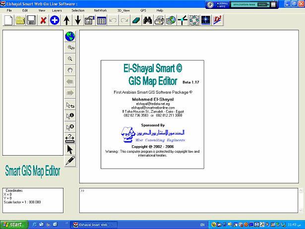
Figure 1. Elshayal Smart GIS Map Editor First View
APPENDIX A. List of Menus
File Menu
- New, adds a new map project on the map viewer
- Open, opens or retrieves a saved map project on the map viewer
- Save, saves a set of layers as a map project
- Save as, saves a map project with different name
- Print Map, prints the extent of the map that appear in the map viewer
- Save Image, saves a map as an image
- Close, closes the current map project
- Exit, exits the program
Edit Menu
- Edit Undo ( under construction )
- Edit Redo ( under construction )
- Convert coordinates System
Edit Sub Menu ( Right click + Map edit mode + Over edit feature)
- Delete vertex
- Delete Part
- Delete Feature
- Insert Vertex
- Get Vertex XY
- Move Distance
- Move to XY
- Move Settings Menu
- Bring part to front
- Send part to Back
- Length
- Area
- Stop Edit
View Menu
- Full Extend
- Zoom in
- Zoom out
- Zoom Previous
- Zoom Next
- Refresh Map
- Copy Map to clipboard
Layers Menu
- Move up, Moves the selected layer up.
- Move Down, moves the selected layer down.
- Show all, select and show all layers.
- Hide all, Unselect and hide all layers.
- New Layer, Build new Layer (Point, Plotline, Polygon).
- Add Layer, adds a layer on the map viewer.
- Save Layer, Save layer shape file to disk.
- Save Layer As, save layer shape file with new file name.
- Remove Layer, removes layer from a map project on the map viewer.
- Remove deleted Features, removes deleted features and save layer.
- Convert Shape type (plotline to polygon and polygon to plotline).
- Reload Layer, Reload the same layer data source.
- Set Layer Data Source, and change the layer data source.
- Open Data Table, displays the selected layer Data Table for editing.
- Open Layer Properties, displays the selected layer properties for editing.
- Zoom to Layer; zoom to the selected layer boundary.
Selection Menu
- Find by data Query builder, Finds features by its attributes and reflect the selection on the map viewer.
- Find by Location Query builder, Finds features by its locations and reflect the selection on the map viewer.
- Cut and past selected features to another layer.
- Copy and past selected features to another layer.
- Delete selected features, Deletes all selected features
- Invert selected features, select all unselected features, and unselect all selected features.
- Erase selected feature, and unselect all the selected features.
- Zoom to Selected Features, zooms to all selected features.
Network Menu
- Build Network, build a network files for the selected shapes files.
- Edit Network, (under construction) Edit Directions and intersections on/off
- Network menu, Open the Shortest path menu for selecting the layer, field, first point, second point, and calculate the route.
- Clear Shortest Path, and clears the stored shortest path.
3D View Menu
- Turn on, Show a 3D View in the map viewer.
- Turn off, Show a 2D View in the map viewer
- 3D toggle.
GPS Menu
- Trace on, show the GPS point in the map viewer.
- Trace off, hide the GPS point in the map viewer
- GPS Settings menu, Open the GPS Setting menu for selecting the GPS port, color and width of GPS point, coordinates system.
Help Menu
- Elshayal Smart Web on Line, Open http://freesmartgis.blogspot.com/ Web Site
- About, Show about menu, which contain the author information.

No comments:
Post a Comment