فيديوهات شرح منظومة سمارت جى اى اس Smart GIS Tutorials Videos
GIS Software Elshayal Smart GIS Server
It is a CGI Map Server that allow the users for viewing and analyzing shape files in web browsers and it works on Internet Server as a GIS CGI That read Shape files and Data base files on the server and produce an appropriate maps images and tables in the browsers of internet users. It gives the internet users the following functions:
- View Shapes and Data base layers through the internet
- Search and Query with complete SQL power
- Calculate the shortest Path between 2 points
- Receiving and drawing the internet users GPS Readings and locations.
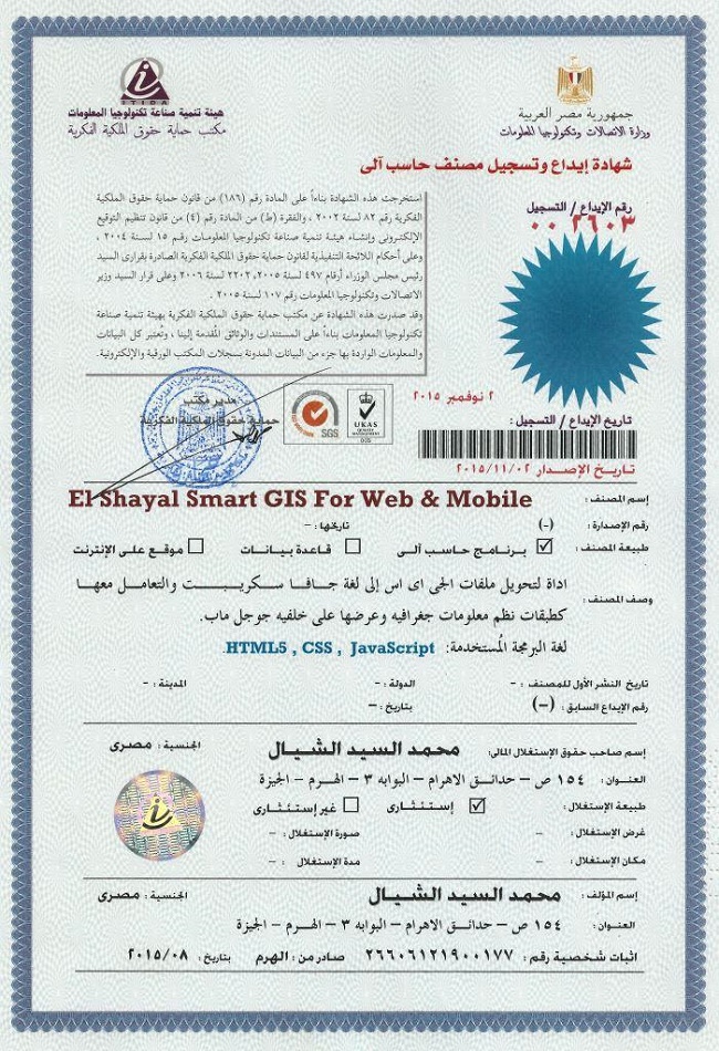
تسجيل منظومة سمارت جى اى اس ايتيدا Smart GIS Registeration in ITIDA
https://login.itida.gov.eg/ViewProfileFull.aspx?ID=2814
شهادات منظومة سمارت جى اى اس Smart GIS Certificates
https://drive.google.com/folderview?id=0B2qR4wxKKE_VflFBZk5mcTRneWRoTVhMLUlPTXZ6SXJuOUdfdFp6amMyQURHSlYxZUoyR0U&usp=sharing
https://login.itida.gov.eg/ViewProfileFull.aspx?ID=2814
شهادات منظومة سمارت جى اى اس Smart GIS Certificates
https://drive.google.com/folderview?id=0B2qR4wxKKE_VflFBZk5mcTRneWRoTVhMLUlPTXZ6SXJuOUdfdFp6amMyQURHSlYxZUoyR0U&usp=sharing


Thanks for sharing gps tracking device dubai
ReplyDelete